Barcelona’s grid only makes sense when you read the older city beneath it
Cerdà’s Eixample made Barcelona famous for octagonal blocks, but the grid overlays Roman Barcino, medieval density, demolished walls and today’s superblock debate.
Tomáš Hare ·
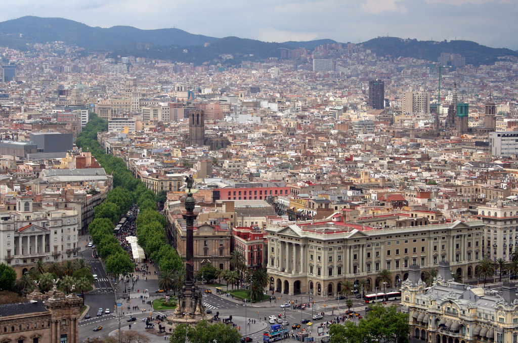
Barcelona is often introduced from above. The Eixample’s chamfered blocks, repeated intersections and long avenues look like a city drawn with confident geometry. But the grid was not placed on an empty sheet. It grew around and beyond an older Barcelona: Roman Barcino, medieval streets, markets, workshops, churches and defensive walls that kept a dense industrial city pressed toward the sea.

The modern plan began as both an engineering proposal and a public-health response. By the mid-nineteenth century Barcelona was crowded, polluted and constrained by military walls. After the walls came down, Ildefons Cerdà’s 1859 plan spread a regular extension across the plain between the old city and surrounding municipalities such as Gràcia, which Barcelona later absorbed. The aim was not only traffic. Cerdà wanted light, air, mobility and a more equal distribution of urban space.
The famous block is the mechanism. Chamfered corners improved visibility and turning. Wide streets were meant to move people, goods, air and eventually new forms of transport. Interior courtyards were imagined as relief from density, with greenery and ventilation inside ordinary blocks. The plan’s geometry therefore carried a social argument: the city should not reserve breathable space only for elites.

Reality complicated the ideal. Speculation, rising land values and later car dominance filled many courtyards, increased building heights and turned generous streets into noisy traffic corridors. The grid remained legible, but some of its original health benefits were weakened. This is why Barcelona’s contemporary superblock policies are not a random fashion. They are a new attempt to recover air, shade, local movement and public life from a geometry that was partly designed for those purposes in the first place.
The older city keeps shaping the map as well. The Gothic Quarter’s narrow streets, Roman remains, La Rambla’s edge, markets and port routes do not behave like Eixample blocks. They remind visitors that Barcelona is a layered urban landscape, not one perfect diagram. Even the tiles underfoot, the sewers below them and the metro lines beneath that are part of a vertical geography in which each generation adapts what it inherited.
The limits are important. A beautiful aerial view can hide inequality, overheated streets, tourist pressure and conflicts over housing. Urban design can create possibilities, but it cannot by itself guarantee affordable homes or cleaner air. Barcelona’s hopeful lesson is more demanding: good city geography keeps revisiting old plans under new conditions. Cerdà’s grid matters because it was a tool, not a relic. Reading the older city beneath it helps explain why the next version of Barcelona must be measured not only by symmetry, but by who can breathe, move, meet and remain there. That is also why the city rewards slow looking at street level. A corner cut for visibility, a market squeezed into older fabric, or a shaded school street can reveal more about Barcelona’s future than another perfect aerial photograph. It shifts attention from form alone to performance: shade, walking distance, noise, housing pressure, neighbourhood memory and the daily right to use the street.