The Island That Teaches Wind to Turn
Tenerife and the Canary Islands make invisible air visible: trade winds split around volcanic relief, lift into cloud seas and sometimes spin into von Kármán vortices seen from space.
Ada Brooks ·
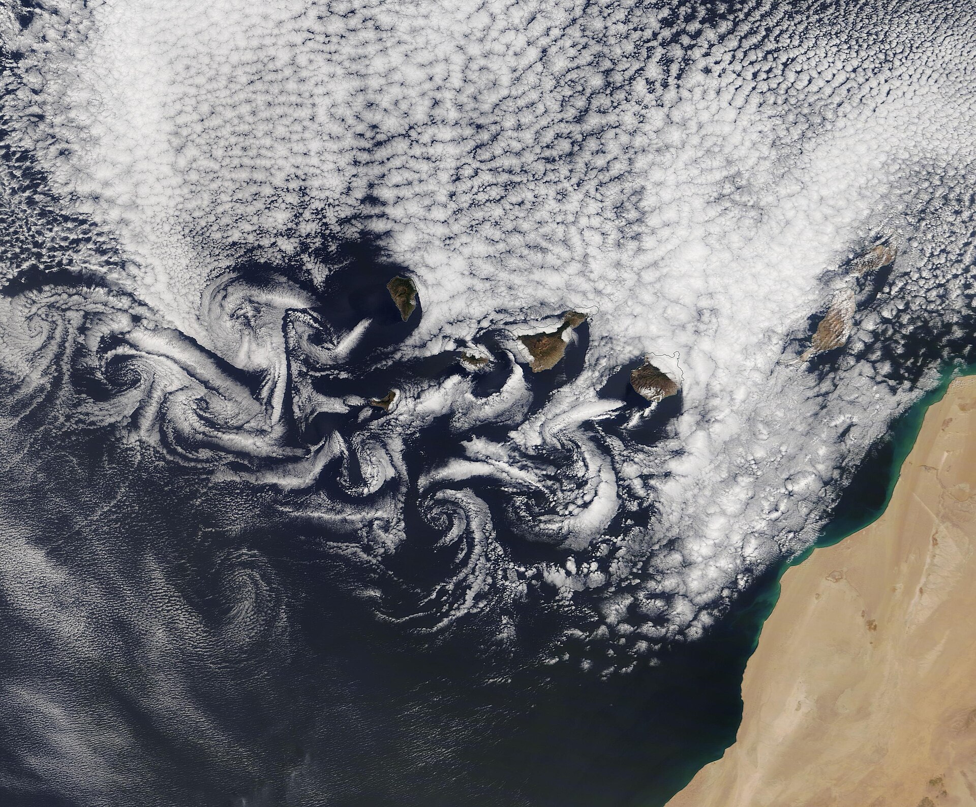
Tenerife teaches the wind to turn by standing in its way. The island rises from the Atlantic into the trade winds, and Mount Teide lifts the obstacle to more than 3,700 meters. Air that looks invisible from the ground becomes legible from space: it splits around the volcanic mass, climbs, cools, forms cloud banks and sometimes spins into long trains of von Kármán vortices downwind of the Canary Islands.
This is why the story belongs to geography rather than weather trivia. An island is not only land surrounded by water. It is a three-dimensional instrument placed inside moving air and ocean. Its height, slope, temperature, vegetation and position in the trade-wind belt decide where clouds gather, where rain falls, where farms can survive and where settlements learned to expect dryness.
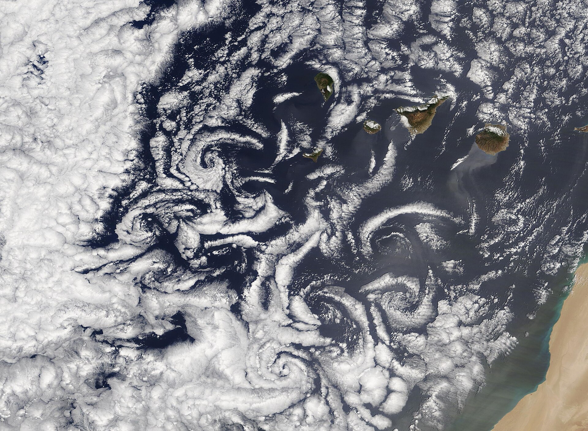
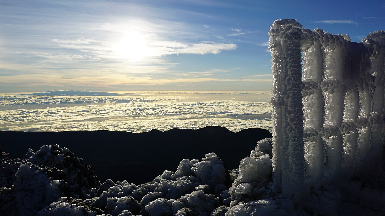
The mechanism begins with the northeast trade winds. As moist air approaches Tenerife, the lower atmosphere is forced upward along the windward slopes. Rising air cools, water vapor condenses and the familiar sea of clouds forms along the island’s northern and higher flanks. Above the trade-wind inversion, the air can be much drier and clearer. That vertical structure helps explain why one island can contain damp laurel forest, pine slopes, dry southern coasts and a high volcanic summit within a short distance.
Behind the island, the airflow has to rejoin. Under the right conditions it sheds alternating eddies, rather like water curling behind a stone in a stream. Satellites reveal those eddies because clouds trace their curves. The island has not literally taught the wind a lesson, but its topography has forced the atmosphere into a repeatable pattern that scientists can observe, model and compare with fluid dynamics.
The human consequences are practical. Windward slopes collect more moisture and historically supported different crops, forests and water strategies than the leeward south. Ports, roads, tourist towns and protected natural areas all sit inside this climatic patchwork. A visitor may experience it as a quick change from cloud to sun; residents experience it as water availability, fire risk, farming choice and building exposure.
There are limits to the metaphor. Not every cloud swirl is caused by Tenerife alone, and satellite images capture particular days, not a permanent portrait. Regional pressure systems, Saharan dust, ocean temperature and seasonal shifts all change the pattern. Climate change adds another layer by altering heat, drought stress and the reliability of old local expectations. The lesson is therefore not that geography is fixed. It is that fixed landforms and changing air continually remake one another.
For readers, the island offers a beautiful way to see scale. A mountain that hikers know by trail and shadow also writes curves hundreds of kilometers long into the sky. The hopeful part is observational: once we learn to read those curves, invisible systems become public knowledge. Wind, cloud and place stop being background and become a map of relationships we can respect.
That reading also helps with planning. Trails, observatories, farms and towns all benefit when forecasts are tied to slope, altitude and exposure rather than averaged across the whole island.