San Francisco’s Metropolitan Mosaic
A NASA Earth Observatory view of San Francisco turns the Bay Area into a readable mosaic of bridges, neighborhoods, parks, ports, water and hills—an orbital lesson in how a metropolis is organized by its edges.
Sofia Lane ·
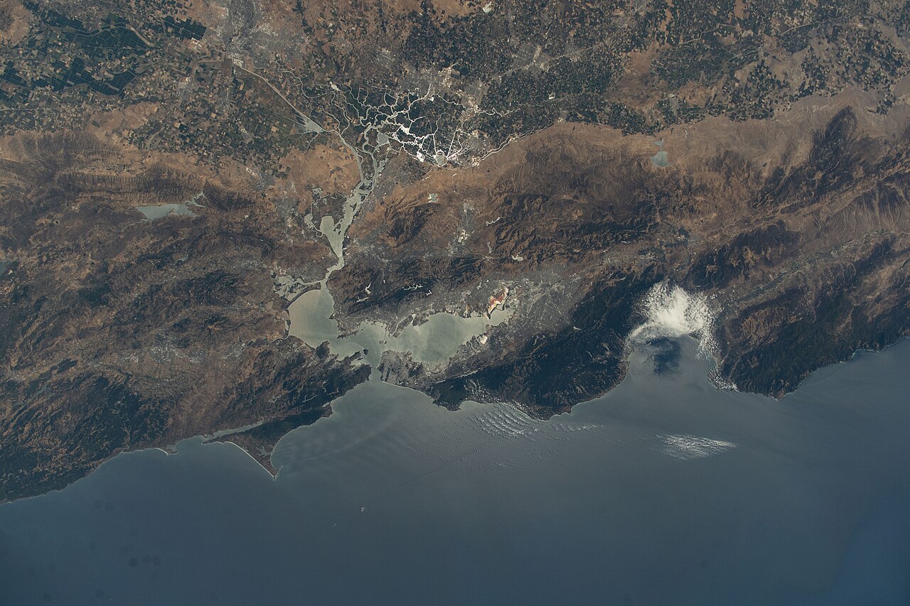
An astronaut photograph of San Francisco does something a street map cannot. It removes the noise of addresses and lets the whole metropolitan shape appear at once: a peninsula, a bay, bridges thrown across water, hills behind dense neighborhoods, green rectangles of parks and the bright edges of ports, airports and salt ponds. NASA Earth Observatory’s image turns a familiar city into a lesson in how geography organizes urban life.
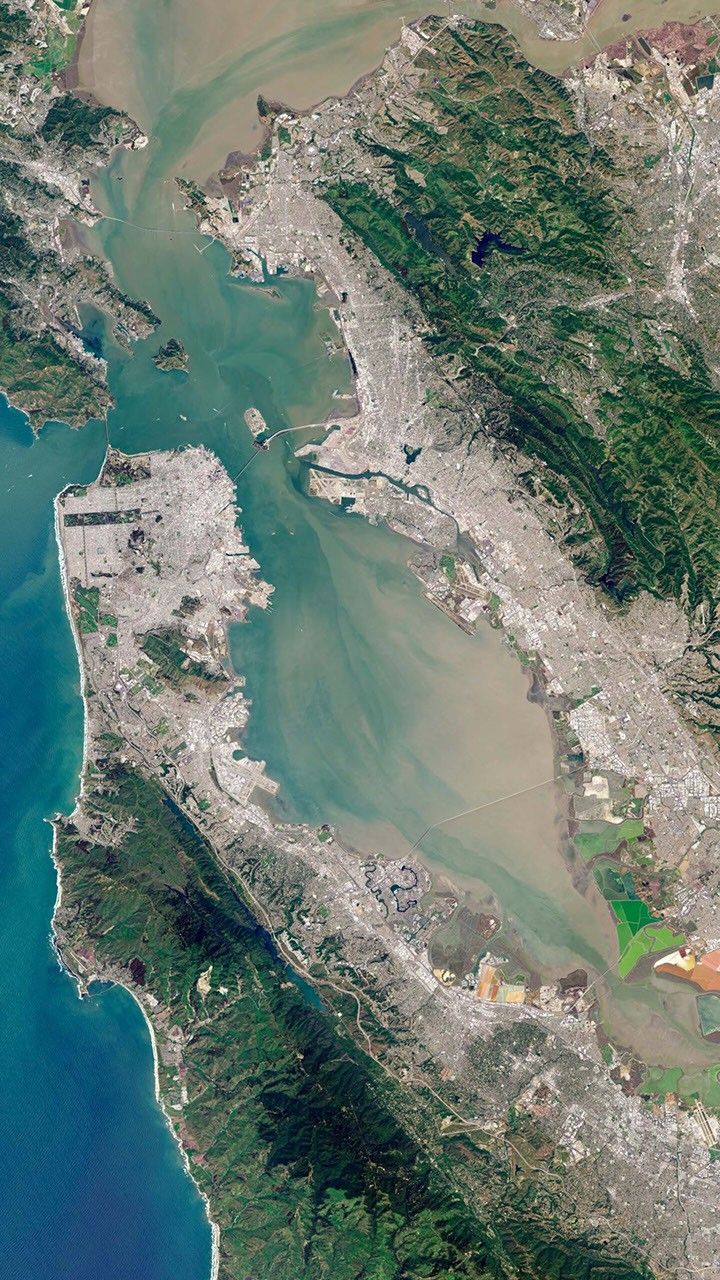
The first thing to read is water. San Francisco sits near the mouth of a large estuary where the Pacific, the Golden Gate, San Pablo Bay and the wider San Francisco Bay system meet. The Golden Gate Bridge marks the narrow opening to the ocean; the Bay Bridge pulls the peninsula toward Oakland and the East Bay; the San Mateo and Dumbarton crossings farther south reveal that commuting geography is also water geography. The bay is not a backdrop. It is the reason routes bend, ports cluster, airports occupy flat margins and neighborhoods grow where firm land allows.
The second layer is density. From space, downtown and nearby neighborhoods appear as a tight urban fabric, while Golden Gate Park stands out as a long green bar. That contrast is not decorative. Parks, military reservations turned open space, coastal bluffs and steep slopes interrupt the grid and give residents cooling, recreation and ecological corridors. They also show choices: cities decide which rectangles become streets, which become public green space and which remain constrained by terrain.
A third layer is regional interdependence. San Francisco’s name often stands for the whole Bay Area, but the orbital view refuses that simplification. Oakland, Berkeley, Marin, the Peninsula, Silicon Valley, ports, refineries, wetlands, hills and suburbs all appear as parts of one system. Jobs, housing, traffic, fog, wildfire smoke, sea-level risk and habitat restoration do not respect city boundaries. The photograph therefore reads like a planning diagram: every bridge is a promise of connection and a possible bottleneck; every shoreline is both real estate and flood edge.
There are limits to the image. A sunny break in the clouds can make the city look calmer and more legible than it feels on the ground. Satellite and astronaut views do not show rent pressure, displacement, transit reliability, neighborhood culture or the daily inequality hidden inside beautiful geometry. Remote sensing can identify land, water, vegetation and infrastructure, but it cannot by itself tell who benefits from them.
Still, the view is useful because it teaches scale. A pedestrian knows a hill by their legs; a commuter knows the bay by a delayed bridge crossing; an ecologist knows the wetlands by bird habitat and sediment. From orbit those experiences join. San Francisco’s mosaic is not a postcard but a working coastal machine, beautiful because its pieces are visible and vulnerable because the same edges that make it legible also expose it to sea-level rise, storms and congestion. To see the city from space is to see that urban geography is never just urban. It is water, rock, climate, transport and human choice sharing the same frame.